






Assyrians
Armies among the old capitals
In 331 BC, Darius assembled his army in the country around Arbela and prepared to fight Alexander on the plain of Gaugamela. The final great battle for the Persian monarchy took place in a region whose cities had once directed an empire of their own. Nineveh and Kalhu belonged to a royal past already centuries old.
The Assyrian monarchy had fallen, but its former heartland remained inhabited and strategically important. Rivers, agricultural plains and routes towards the Zagros continued to support communities and attract armies. The Macedonian conquest crossed a country whose history reached well beyond the sovereigns now fighting over it.
The upper Tigris country
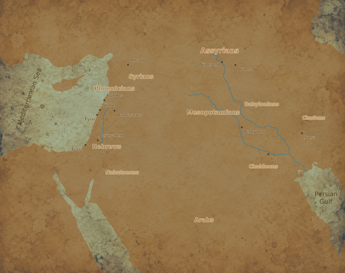
The historic heartland of Assyria lay around the Tigris in northern Mesopotamia. Ashur gave the country and its principal god their name; Kalhu and Nineveh became great royal centres. To the east, the country opened towards the foothills and passes of the Zagros. To the west lay routes towards the Euphrates and Syria.
These connections made the region valuable to successive powers. Armies moving between the Iranian plateau and the western provinces needed crossings, food and roads. Communities on their routes might supply transport and provisions while facing the danger that a military setback would turn the same roads into paths of flight.
The plains and neighbouring uplands offered different resources and military conditions. Cultivation could sustain substantial settlement, while hills and river lines shaped an army's approaches. At Gaugamela, the choice of ground became part of Darius' attempt to bring the empire's varied forces into effective action.
The kings who built an empire
During the first millennium BC, Assyrian rulers expanded far beyond this homeland. Ashurnasirpal II made Kalhu a monumental capital in the ninth century, gathering a court whose art announced royal victories and divine protection. Later kings extended Assyrian power across much of the Near East.
Palace reliefs presented warfare as an ordered demonstration of kingship. Armies crossed rivers, attacked fortified cities and brought captives and tribute before the ruler. The images made conquest visible to people admitted to the royal spaces, while inscriptions proclaimed the sovereign's achievements.
Expansion also moved populations. Deportation transferred people, skills and obligations across the empire, making its communities more interconnected through coercion. The wealth displayed in a palace could carry the history of a defeated town, a displaced household or an artisan working far from home.
Nineveh and the royal image
Sennacherib developed Nineveh into a magnificent centre of rule. His successors maintained a court whose buildings, sculptures and written collections expressed the resources of the monarchy. Ashurbanipal's name became especially associated with the gathering of learned texts.
Knowledge served authority as well as preservation. Royal scholars interpreted signs, advised the court and copied works through which the world and its dangers could be understood. The king's confidence in divine support coexisted with the constant need to identify threats and act before disaster.
The surviving monuments give this imperial culture exceptional visibility. They preserve a particular moment of Assyrian royal power, long before Alexander. The region he entered had passed through profound political changes since the courts that commissioned those works.
The fall of the monarchy
At the end of the seventh century BC, the Assyrian Empire collapsed under the attacks of its enemies. Nineveh fell in 612 BC to the forces of Babylonia and Media. The remaining resistance continued farther west before the monarchy disappeared.
The devastation changed the old capitals. Palaces and fortifications that had concentrated imperial wealth became damaged places within a transformed landscape. At Kalhu, archaeological evidence indicates that some inhabitants returned among the ruins after the destruction.
The end of a dynasty did not make the entire country empty. People still cultivated land, occupied settlements and moved through the region. The later political map placed these communities within new powers whose requirements drew on the same agricultural and strategic advantages.
Xenophon's ruined cities
In 401 BC, the Greek soldiers returning after Cyrus the Younger's failed revolt passed great deserted sites beside the Tigris. Xenophon called them Larisa and Mespila, generally identified with Kalhu and Nineveh. He described immense walls and told stories explaining how they had been captured.
His account attributed them to the Medes, revealing how the memory available to a passing army differed from the history preserved in their inscriptions. The monuments remained extraordinary even when the names of the builders were no longer securely known to the visitors.
For the Greeks, these places formed stages in a dangerous march under Persian pressure. The remnants of an earlier empire offered landmarks and temporary surroundings for another army's struggle to survive. Great walls could outlast the monarchy that had paid for them without retaining their former political meaning.
Under the Achaemenids
The Persian Empire incorporated Mesopotamia into a realm extending from the Aegean to the Iranian plateau and beyond. The name Athura appears in royal lists, preserving an Assyrian designation within the geography of imperial rule. Aramaic helped connect administration across territories that had once belonged to competing kingdoms.
Communities in the old Assyrian lands now faced obligations determined within this larger order. Men, produce and revenues could be called upon for royal purposes. Routes through the region linked governors and armies with Babylonia, Armenia, Media and the lands to the west.
Greek writers used the names Assyria and Syria with varying geographical reach. Their accounts nevertheless reveal how strongly the memory of Assyria continued to shape descriptions of the Near East. An empire that had ceased to exist remained present in the language used for the countries that followed it.
Soldiers in the royal muster
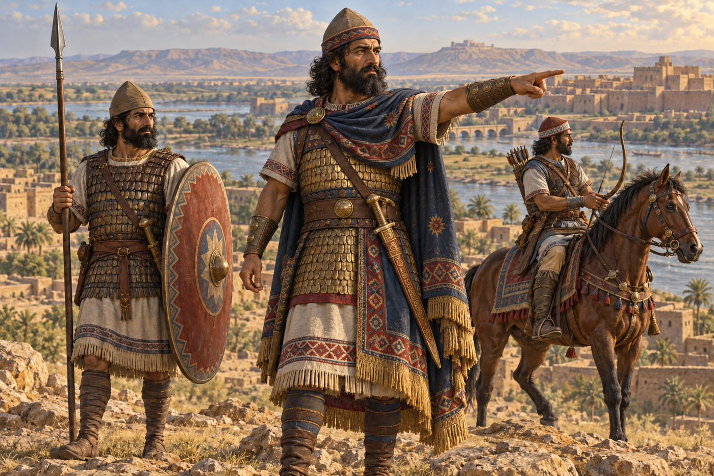
Herodotus included Assyrians in Xerxes' expedition of 480 BC. He described helmets of bronze or woven construction, shields, spears, knives, iron-studded wooden clubs and linen cuirasses. The passage places men identified with the old country within a Persian imperial army.
The regional military tradition therefore entered a different system of command. Service could carry soldiers far from the Tigris while their equipment and name distinguished them in an outsider's catalogue. The Persian king drew upon populations whose histories of warfare were older than his dynasty.
By Alexander's generation, the decisive royal army gathered contributions from many such regions. Darius' forces brought together cavalry, infantry and specialist troops from across his dominions. Northern Mesopotamia supplied the ground upon which their combined strength would be tested.
Gaugamela and Arbela
Darius selected open terrain near Gaugamela and prepared it for his army. His plan sought to use numerical reach, cavalry and chariots against the smaller Macedonian force. Alexander approached with an army whose experience and cohesion had already produced victory at Issus.
The battle broke the Persian position. Darius escaped towards Media, and Alexander pursued towards Arbela in the hope of capturing him. The king had gone, but money, baggage and royal equipment fell into Macedonian hands.
The name Arbela became attached to the victory in much later memory, although the fighting had occurred elsewhere on the plain. For the surrounding country, both places belonged to the same crisis: the concentration of a great army, its defeat and the movement of the pursuers towards the resources left behind.
A country within new kingdoms
Alexander moved south towards Babylon rather than remaining to pursue Darius into Media immediately. The victory in the former Assyrian heartland opened his way to the principal royal centres of Mesopotamia and Iran. The country had again become a hinge in a contest extending across the Near East.
After his death, the successors fought over those connections and resources. Northern Mesopotamia remained part of the geography binding western Asia to the Iranian interior. Its towns and agricultural districts faced changing governors and the demands of rival armies.
The Assyrian past survived in ruins, names and inherited practices. At the time of Alexander, it was the deep history beneath a living country, one whose inhabitants continued to work the fields and roads over which conquerors passed. The loss of an ancient imperial crown had not ended the importance of the land that once sustained it.
Sources
Ancient narratives
- Xenophon, Anabasis, III.4: Larisa and Mespila.
- Herodotus, Histories, VII.63.
- Arrian, Anabasis, III.8–16, particularly the pursuit to Arbela.
Archaeology and historical studies